USA Map Jigsaw Puzzle
Three maps of the United States, each drawn in its own style and all free to play. Putting one together a few times is a slow, hands-on way to learn where the states sit and which ones share a border.
All USA map puzzles
Which of the three maps should I choose?
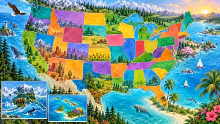
Choose Map of the United States if the goal is learning the states. All 50 are drawn in clearly different colors on a pale blue ocean, with Alaska and Hawaii in inset boxes, so every state reads as its own patch. The other two maps trade a little of that clarity for pictures to find.
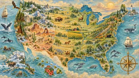
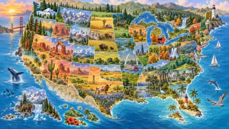
Illustrated USA Map with Landmarks has small drawings dotted across the country, among them a lighthouse, mountains, a cactus, a redwood, a riverboat and a bridge. A state is easier to remember when something sits on it. The Vintage USA Map is the grown-up choice, with muted parchment tones, a compass rose and gentle sea creatures in the oceans. The landmark map and the vintage map carry no labels or lettering at all, which turns out to be useful.
Can a map puzzle help children learn the states?
Yes, as long as someone names the states as they go in. The puzzle supplies the shape and the neighbors, and a parent or teacher supplies the name. Because two of the maps have no labels, they also make a fair test later on, once a child feels sure of the map.
Teachers and homeschool families can begin with the colored map at 24 or 36 pieces. A big state like Texas spans a couple of pieces at that size, while the small northeastern states crowd into one. Step up to 80 or 104 next. Each state is then cut across more pieces, so children have to know it by its outline rather than a block of color. The landmark map suits a short project too. Place the redwood, then ask which coast it grows on in real life. A class can also open the same map in a room and build it together, each child on their own device.
What is the best way to put a map puzzle together?
Work from the outside in. The coastlines and the long straight stretch of the northern border give you a frame, and on the colored map the Alaska and Hawaii insets are easy early wins. The ocean is the hardest part of all three maps, so leave it until the land is finished.
- Pull out the edge pieces and anything showing coastline.
- Build the inset boxes, or the compass rose if you are on the vintage map.
- Group the states by color and check each one against the borders of its neighbors.
- Place the small drawings, the landmarks on one map and the sea creatures on the other.
- Fill the ocean last, matching each piece to the bit of coast it touches.
The pale blue water on the colored map is quiet on purpose, and the old paper on the vintage map shifts gently in tone, so both ask for patience at the finish. At 300 pieces or more the vintage map makes a proper evening project. For cities and landmarks beyond the map, try the Travel category or the New York puzzles.